Our transport planners developed a long list of possible options for how we could do this route, looking at things from a range of different perspectives, thinking about all the possibilities and what could be achieved. These were whittled down to a short list of four viable options.
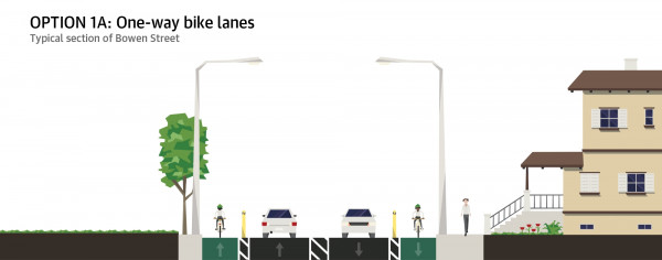
Option 1A
- One-way separated bike lanes (uphill and downhill)
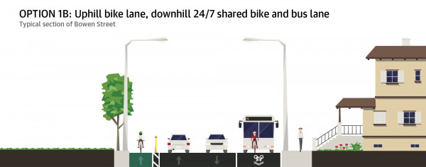
Option 1B
- Uphill separated bike lane, downhill shared bus and bike lane
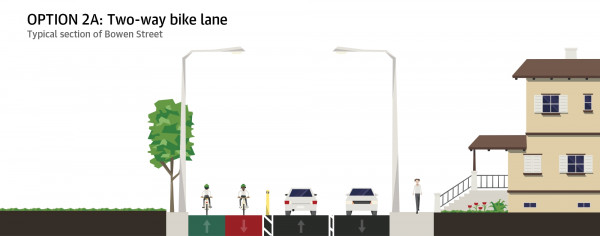
Option 2A
- Two-way bike lane – removal of parking, more space for urban design improvements
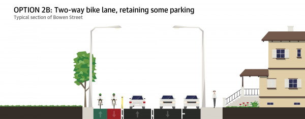
Option 2B
- Two-way bike lane – retain some parking
Option 1A scored the highest but as there isn’t enough space along the whole route for bike lanes on both sides, we’ve gone with a modified version of option 1B.
Considerations
Things that were considered included connections for bikes, pedestrian safety, bus lanes, street widths, street layouts including one-way systems, intersections and traffic signals, and the effect on parking.
Things that weren’t considered in the assessment of the long list included using alternative routes, using space on the sealed road shoulder, shared paths (except for short distances where there was no other option), shared zones and digging up kerbs to make more space.
For consistency, the multi-criteria assessment (MCA) for this project used the same criteria and considerations developed by Let’s Get Wellington Moving (LGWM). The benefits and compromises of the interim project designs can be assessed as part of future design work for LGWM projects.
Supporting documents
Look at the plans, parking management plans, detailed information on the options we considered and more.
Evaluating the changes
We'll be monitoring and evaluating the street changes alongside community feedback.
Project details
Learn more about the changes made on this route to make it safer and easier for more people to walk, bus, and bike.