Information on this page was correct at the time of consultation, and some of it will now be out of date.  See this page for up to date information

He tāone e hāngai ana ki te anamata
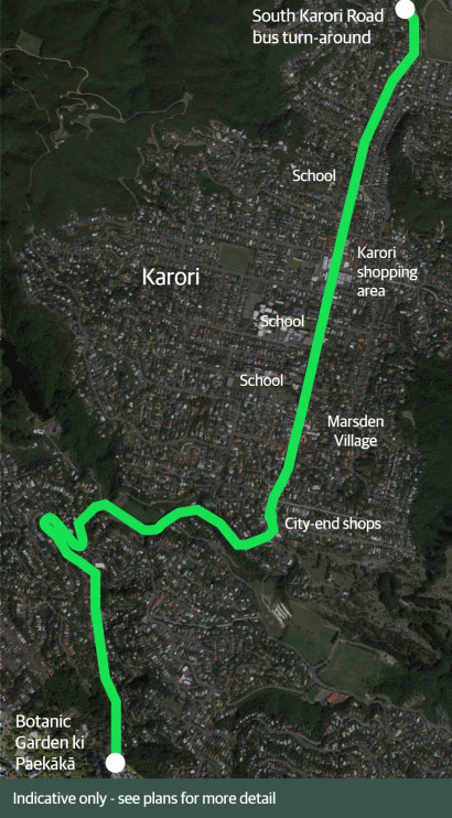
Preparing for the future – providing more options for more people

Swipe through the changes below to see how different people will experience the changes.

Ngā panonitanga I Changes at a glance

The route2x

The route

Key changes include:

  • changes to bus stops, bus lanes, and road layout to improve travel times for buses, and provide for more or longer buses
  • uphill bike lanes to better protect people on bikes. This will also free up general traffic where speed differences are greatest.
  • raising existing pedestrian crossings and installing new crossings
  • two short extensions to existing shared paths
  • improving kerb ramps
  • a new shared path through Appleton Park
  • calmer traffic speeds through retail areas

1 / 5

Changes for walkers2x

Changes for pedestrians

Improved and new pedestrian crossings, better kerb ramps, and calmer traffic speeds in retail areas will make journeys around Karori safer and easier for people on foot or with mobility aides and pushchairs.  

Key changes include:

  • raising eight existing zebra crossings along the route
  • two new raised zebra pedestrian crossings, two new raised courtesy crossings, and three new refuge islands
  • calmer vehicle speeds near schools and shopping areas
  • a new shared path through Appleton Park.

2 / 5

Changes for bikes2x

Changes for people on bikes

The changes include bike lanes in uphill sections providing better protection for people on bikes. This will also free up general traffic where speed differences are greatest.

Key changes include:

  • uphill bike lanes along Glenmore Street, Chaytor Street, Karori Road, and Birdwood Street
  • a shared path through Appleton Park
  • Calmer traffic speeds near shopping areas and schools.

3 / 5

busstop web karori

Changes for people on buses

Changes to bus stops, bus lanes, and road layout will improve travel times for buses and provide for more or longer buses.

Key changes include:

  • lengthening most bus stops to allow for more or longer buses
  • widening Glenmore Street around the horseshoe bend to better accommodate buses and people on bikes
  • improving bus stop spacing where they are too close together, for quicker bus journeys.
  • converting two bus stops to in-lane bus stops to reduce delays merging back into traffic, and improve access onto buses
  • exchanging the downhill bus lane on Chaytor Street as far as Curtis Street for an uphill bike lane, which Metlink advises will improve overall bus journey times

4 / 5

Changes for cars2x

Changes for people driving

The changes in road layout will make it easier for people driving to share the road safely and travel at safe speeds.

Key changes include:

  • separating bikes on uphill sections, helping buses and cars pass safely
  • traffic calming near schools and shopping areas with raised crossings and pedestrian refuge islands
  • two in-lane bus stops to help prioritise bus journeys may result in slightly longer travel times
  • significant parking changes along Glenmore Street and Karori Road.

5 / 5

Changes based on community feedback

Over 50 changes were made to the proposed designs based on community consultation. These changes include:

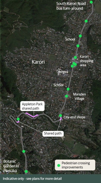
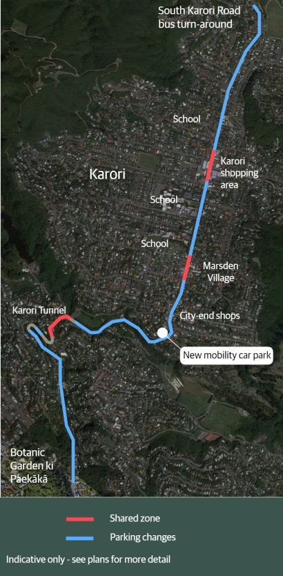
  • providing better kerb access for vehicle passengers, and eight extra carparks including dedicated visitors parking, by moving the carparking from the Botanic Garden side of Glenmore Street to the residential side of the road.
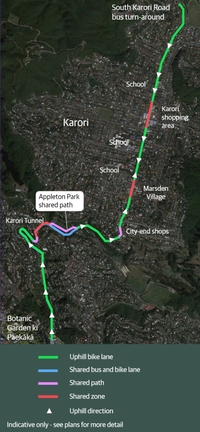
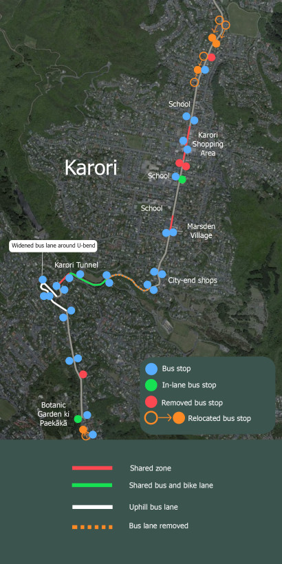
  • changing three proposed in-lane bus stops to kerbside bus stops in locations where it is safe to do so
  • creating extra parking provisions along the route for residents and businesses
  • retaining the right hand turn into Homewood Ave to minimise queues
  • improving patient access to Singleton Dental by adding one mobility park and one P5 drop-off/pick-up park
  • providing better bus stop spacing by moving the bus stops outside Karori Park to the east by 100m
  • giving parents/caregivers more time to pick up and drop off children by changing P10 parks outside Marsden School to P15 parks.